Off Road Vehicle GPS Setup

Prospecting Australia

Help Support Prospecting Australia:

This site may earn a commission from merchant affiliate links, including eBay, Amazon, and others.
G

Guest

HI Guys,

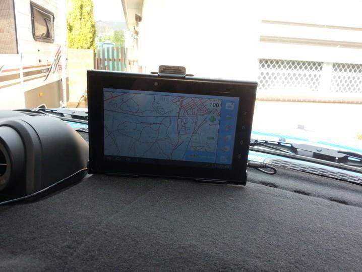
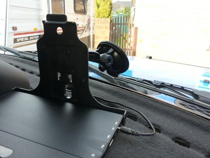
I am looking at getting a setup for the Car using a tablet (eg Windows CE or Ipad)

What are you guys using?

Theirs OZTopo, Ozi explorer and a few others.

Would love to hear your setups which I think is a must when prospecting.

Thanks

Joe
 
I use a Starpad 7" tablet, came with a mount, USB cable, 240V charger and in car charger. It's Android 4, with an inbuilt GPS antenna, so I use Oziexplorer and Vicmapm see pics. I also have a Garmin E20 handheld with topomap.

1393067706_20130827_110940.jpg


1393067752_20130827_111054.jpg
 
I've got an iPad with MemoryMap and Hema running. I also carry a Garmin Nuvi for the City and a Garmin eTrax10 for when I am wandering out in the bush with the metal detector to get me back to the car. I carry a normal compass as a backup and take a bearing on the car before I leave it.
 
hey Gcause,

Talk me through how you take a bearing on your car before you go off wandering. Write slowly 'cos I'm not a quick thinker...

I have oziexplorer on a laptop. I have connected a medallion-looking gps to a usb port. I have just bought a garmin rino. I'll get a compass.... as yet, I haven't used these methods out in the bush. I'm dead nervous in me lounge room about being out in the bush on me own. I spooked myself at Tibooburra when I couldn't find the ute and it was an hour til dark. I'm goin over to WA in a few weeks and I plan to be very cautious.

thanks...

(and I am looking for a sat phone if anybody has one for sale)
 
Assuming you know a little about oziexplorer, I use it to plan where I'm going on my laptop. If I build a track and mark waypoints, I then download to the Android version of Ozieplorer on the Starpad pic above. I also have Ozi on my Samsing Galaxy S3 phone and can follow the same info on it. However if you are using a laptop and external USB GPS antenna, you need to activate "moving map" within Ozi, it will then track your position onto the map within Oziexplorer.

Re your car - 2 methods, first, with the GPS, switch it on at your car, when you have aquired satellite mark a waypoint at the car's location (you can edit this waypoint's name so call it car or something you know. You can then in effect switch it off. When you are ready to finish for the day, switch the GPS back on, then go into the menu and find the car's waypoint and select goto, it will then give a line of sight distance and direction to your car. Remember that you have to be moving to get an idea of direction, if you are vearing away from your car the breadcrumb trail will depart from the track, just keep turning till you are back online.

The second method is to use a map and compass, I'm not going to try to teach you that on here. Here's a link; Do some reading......

http://www.ga.gov.au/image_cache/GA7194.pdf

If I were you, I'ld be practising with the handheld GPS and your laptop in areas you know before you head bush, until you are confident. I also suggest you get a PLB if you are out there on your own, here's a link.

http://www.ja-gps.com.au/GME/mt410g-plb/

Hope this helps
 
Just be careful out there guys. You can move away 50 metres
From the car where vehicle no longer is visible and its not hard
To loose your bearings.

If your heading out and there are various intersections and junctions
Attach a heavy duty chain to your tow bar so it marks the ground.

You can tie ribbons on trees or do what i do when needed.

Carry a 400 metre length 6mm telstra rope and walk out with it.

I only use this method if there are shrubs growing all over mullock

Heaps which masks your position.

The name of the game is taking precautions
 
Levytag said:
hey Gcause,

Talk me through how you take a bearing on your car before you go off wandering. Write slowly 'cos I'm not a quick thinker...

I have oziexplorer on a laptop. I have connected a medallion-looking gps to a usb port. I have just bought a garmin rino. I'll get a compass.... as yet, I haven't used these methods out in the bush. I'm dead nervous in me lounge room about being out in the bush on me own. I spooked myself at Tibooburra when I couldn't find the ute and it was an hour til dark. I'm goin over to WA in a few weeks and I plan to be very cautious.

thanks...

(and I am looking for a sat phone if anybody has one for sale)

Beware that in flat feature less scrub country (ie no landmarks to triangulate your position off) simply taking a compass bearing when leaving your car is only useful in finding your way back to it if you intend to walk in dead straight line out and back because any deviation from that bearing will affect your easting and/or northing and more so the further out you go from your start point. So returning on your back bearing would (if you were counting your paces) bring you back to a different location to the one that you left from. If you're super lucky you might be able to see your car in the distance - but because nobody counts their paces you'll probably walk straight past your car having missed it by 500 metres....... and you're lost!!

However a compass and can GPS compliment each other. Learn how to orientate a map with a compass, and find your position on that map using triangulation, or find your position on that map using GPS coordinates from your favourite device and you'll feel much more confident about venturing into the bush or the outback.

casper
 
yeah, thanks, fellas, that is all good advice ... this is my month for getting slick with the nav gear and I'll start with your tips ...

I have selected an area to prospect and I have been marking waypoints on ozi... abd mines, wells, mounts, track junctions. I will stay around this area and get to know it well. I'll have this laptop running in the truck with the truck position on the map. I won't wander too far from my truck... maybe I'll do a one km area to death and then move the truck, at least in the beginning.

thanks
 
Levytag said:
yeah, thanks, fellas, that is all good advice ... this is my month for getting slick with the nav gear and I'll start with your tips ...

I have selected an area to prospect and I have been marking waypoints on ozi... abd mines, wells, mounts, track junctions. I will stay around this area and get to know it well. I'll have this laptop running in the truck with the truck position on the map. I won't wander too far from my truck... maybe I'll do a one km area to death and then move the truck, at least in the beginning.

thanks

You may know your truck location on Ozi, any tracks or waypoints you create can be downloaded to your Rino. However if you mark your truck location on the Rino before you leave it, you will always be able to head back to the truck's waypoint. Try it.
 
Levytag be careful not to wander too far from your truck, where I am going you can wander 500mtrs from it and not be able to sight it. Lots of thick scrub. I didn't have a GPS when I first started so relied on my compass and the sun to navigate.

A compass bearing is only a good start to get you going in the general direction like others have said it can put you well off from where you need to be. The reason is that no human can walk a straight line no matter how hard they try as one leg will always be shorter than the other so you will walk in a long arc / circle.

I note which side the sun is hitting me from when I go into the bush and take into consideration the time of day. I then walk back out with the sun on the other side depending on time of day. I am also in state forest. So state forest tracks are roughly 1km in grids. So at worst I have a 4km walk back to the car once I hit a track. So far using the compass / sun method I have been able to get within 10 metres of the car each time.

Also remember the golden rule of being in the bush, don't go out there alone and always let someone else know where you are going and when you plan to be back.
 

Latest posts

Top