casper said:
goldierocks said:
No... and it's not on the list of volcanic craters either - do i get naming rights
")
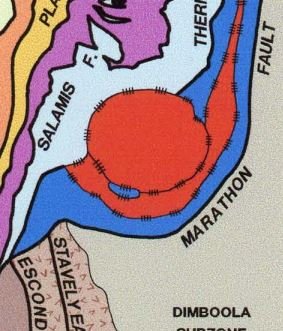
You possibly could if you were to demonstrate that it has features of an impact structure and is not just a circular topographic feature - although others would have to choose to name it after you, it is not your choice. Most circular features are not impact structures (yours is a nice shape though and might be worth investigating). First thing would be to overlay it on a geological map and
check that there is not some other reason for its existence (e.g. a circular igneous intrusion such as a granite). Next thing is while you are there, keep an eye out for shatter cones and pseudotachylite (glassy) dykes, features characteristic of high-velocity impacts. Also the rare minerals stishovite and coesite (unlikely that you would identify these two minerals in the field).