That's nice--show us a pic of your pick mate.. :lol:
You are using an out of date browser. It may not display this or other websites correctly.
You should upgrade or use an alternative browser.
You should upgrade or use an alternative browser.
Navigating in the bush
- Thread starter The geezer
- Start date


Help Support Prospecting Australia:
This site may earn a commission from merchant affiliate
links, including eBay, Amazon, and others.
- Joined
- Mar 9, 2014
- Messages
- 488
- Reaction score
- 389
peterau said:Misplaced my pick recently out from Leonora, took a while but found it. Tried to find some fluro paint in Leonora but that didn't happen, so bought some fluro pink nail polish and done the Picasso thing to it. Would be very hard to lose now.
Keep an eye out, there could be a pro pointer and a bungy strap for a harness as well. Damned if I can find them and that was the last trip I used it 8.(
peterau
Peter
Will do Jaros, do on the weekend, they have weekend activities on here, so wont be out detecting. peterau
peterau
Peter
Hi Jaros, as promised pink pick pic, shouldn't lose it and don't think anyone would want to nick it. cheers peterau

He, he, now you might not forget it but have it mistaken for an artifact of the past and stolen!!??  :lol: :lol:
Yep pretty hard to miss now mate.
Jaros
:lol: :lol: Yep pretty hard to miss now mate.
Jaros
- Joined
- May 28, 2015
- Messages
- 6
- Reaction score
- 2
fjute1955 said:Was just looking at the Magellan range of hand held GPS
You can spend $100 or a $1k depends on budget
I want it to mark points of interest for hunting/prospecting more so then getting lost
But $100 well worth it in my opinion
I think the Garmin's have a better reputation for being more reliable and user friendly.
Same here mate - l'il bit expensive but??ched66 said:I don't go anywhere up bush without the Garmin Etrex 30 nowadays
GoldenDreams said:I think the Garmin's have a better reputation for being more reliable and user friendly.
Garmins are a top GPS......never had any drama's with my Magellan Explorist 510
Either brand will serve you well.
Look after, and love your equipment and it will love you back!
I recently got Hema Explorer on Android. Seems to work well - easy to import kml/kmz files, create & import tracks + waypoints etc. Was less than $40 & includes street maps + 1:250k topo.
Jaros said:Same here mate - l'il bit expensive but??ched66 said:I don't go anywhere up bush without the Garmin Etrex 30 nowadays
Little expensive to pay for mate..........got mine with the excess Qantas points I get through all my time flying to and from work
but 2 weeks after I got mine the offsider had a go and just wanted one so he has one the same now.........come to think of it he did the same when I bought an at gold for a backup to the 5ooo..........bugger's found more yella than me with it now........ 8.( 8.(Muttering
meika
- Joined
- Oct 2, 2013
- Messages
- 73
- Reaction score
- 12
On Getting Unlost.
I, like some others in this thread, have an excellent autopilot. My sense of direction is without peer. I always know where I am. Always.
Except once.
It was a cloudless, shadowless, windless day in a flat area of NE Tasmania (Mt William National Park). A mixed up mosaic of plant communities: scrub, short scrub, tall scrub, knee-high scrub, scrubby rocky patches, scrubby patches of tall trees, stand of short trees over scrub or fern, swampy bits and large puddles, near some scrub.
I was off on a walk when I wondered which direction Mt William was. So I climb a tree and yes there was Mt William once I had broken a few twigs to get a better view.. No worries. Wandered for some time, climbed another tree. Yes there is Mt William. Kept going for a bit and climbed another tree, yes there was Mt William----- why are those twigs broken, looks quite fresh ----OMG
I've gone in circles. WTF to do I do now?
You see the trouble with an excellent sense of direction is that one never had to learn how to get unlost. This is a skill in itself. So if you have an excellent sense of direction bear that in mind when it fails you.
Looking back now I can see that I was already doubting my autopilot because I was ducking up trees, though I wonder if I hadn't broken a few twigs in that first tree how long it would have been before I realised I was lost. If you don't know you are lost then you can't get unlost, only more lost... For an autopilot like that, i.e. that good all the time--- it will be more dangerous when it fails. One needs systems in place.
Anyway I continued with the tree climbing, only triangulating Mt William now with Sandy Cape, picked a tree directly in line with the cape, walked to it and climbed it, sighted the cape and another tree and so on. It took about five trees before I recognized something, and I collapsed for a little rest on the cutting grass...
Looking at a map later I was about 3km in from the track where the ute was, going in circles on a flat area of no relief.
Besides learning to take nothing for granted, that getting "unlost" is a different skill to knowing where you are, I also learnt that adrenalin or panic can be surfed (it got me up those trees) and can focussed one's attention greatly, but only if you have a plan. Fortunately I had been climbing trees already and sighting landmarks before I realised I was lost. What if I had not?
Now when others get lost in the most simple of places, and get anxious, and worried, I have a lot more compassion and I never shake my head at them. I'm lucky but now I know it.
I carry an older garmin GPS with spare batteries and waypoint the car and camp and keep them all on the device because you never know. (Phone is good too but the batteries don't last and it is on all the time anyway.)
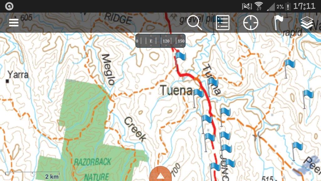
I use combination of IPad mini and old school topo maps.
Memory Map is available on the App Store for the iPad for less than a couple of dollars. The free topo maps that can be cached for offline use are somewhat outdated, but show enough for ballpark navigation. Of more use is the navigational data displayed in whatever your favourite navigational system is, and the usual stuff such as plotting waypoints and routes.
When prospecting, I like to have a detailed paper map that I can cross reference to my GPS, draw, scribble and otherwise annotate all over. They also play nicely with the silva compass.
The DEPI of Victoria produces excellent 1:30000 topo maps that can be downloaded here www.depi.vic.gov.au/vicmap
These maps are in a convenient A4 format, can be printed out as many times as you like, and using a PDF reader, can be zoomed and printed for those areas of particular interest. They do cost $2.50 each, but you only need download those maps relevant to your search area.
As for getting lost, the last time I got lost, was many years ago in NZ bush. I found a dry watercourse, followed it downstream, found a creek, which became a small river, and people love to put towns on rivers! Either that or you eventually end up on the coast, which is slightly less lost than when you started!
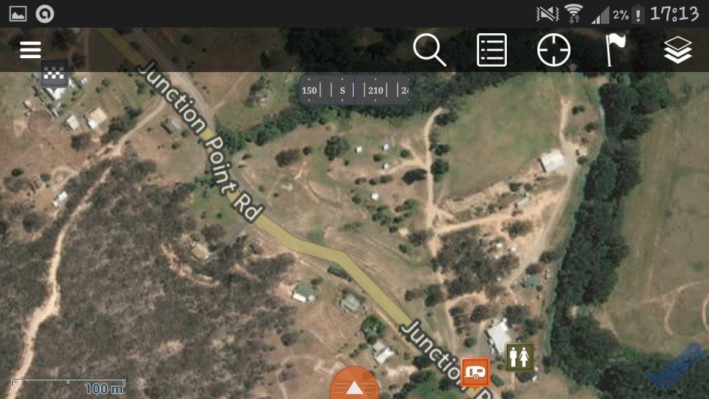
A related topic, is use of the maps that may be included in "Gold" maps that you may get at a detector shop, and their relationship to what you may be able to actually find on the ground in the way of tracks/signs/site features and also how they may relate to some GPS maps. I say this as during a recent outing I found that in some areas of a forest, none of them agreed with each other at all or the track signs located around the site. The closest to actual were tracks in a Garmin vehicle GPS, but some of those were also inadequate.
So take care, and if you have tracking features on your vehicle GPS then make sure that it is activated so that you can retrace your track to an entry point.
"Lost in the bush", not lost but for a couple of minutes I headed the wrong way, but quickly realised it and did a 180. Now, the only place that has always had my head in a spin was Paris in France. For some reason my east and west got mixed up on the first visit and after that I always had to double check my directions against major landmarks.
Rob.
condor22
Mike
The biggest three things in the getting unlost bag of tricks.......
Don't panic, common sense and think the problem.
Don't panic, common sense and think the problem.
- Joined
- May 18, 2015
- Messages
- 707
- Reaction score
- 1,222
Good reading guy's, I haven't really ever been lost in the bushon days when the sun is out I always walk away from it, after 2 or 3 hours I turn and face the sun knowing it moves slowly to the left I would walk slightly to the right and there's the carIt always amazes me that you could be out for quite a few hours but a quick brisk walk can get you back within 15 minutes. That said now in the market for a GPS.
Cheers.
Cheers.