Hi All
Would like to post some selected Data overlay for Google Earth and Ozi-Explorer wpts but would like to know your choice of were is the best off site storage that you like to download from?
I can do 4share if that's ok
NSW Shallow Workings Total 161.zip
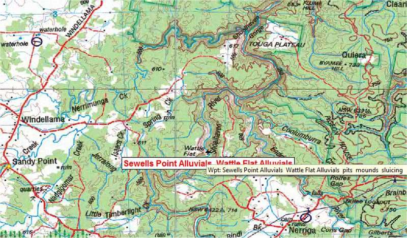
Sewells Point Alluvials
Wattle Flat Alluvials
"3 nuggets were found at ""Wattle Flat"" in 1896 . and a ""very rich alluvial patch"" (McGowan . 1994p178). Also see McGowan (1994 p153-159)."
WP,D,Sewells Point Alluvials Wattle Flat Alluvials,-35.0516059908385,150.026635206822,pits mounds sluicing
Would like to post some selected Data overlay for Google Earth and Ozi-Explorer wpts but would like to know your choice of were is the best off site storage that you like to download from?
I can do 4share if that's ok
NSW Shallow Workings Total 161.zip
Sewells Point Alluvials
Wattle Flat Alluvials
"3 nuggets were found at ""Wattle Flat"" in 1896 . and a ""very rich alluvial patch"" (McGowan . 1994p178). Also see McGowan (1994 p153-159)."
WP,D,Sewells Point Alluvials Wattle Flat Alluvials,-35.0516059908385,150.026635206822,pits mounds sluicing